

Geospatial Intelligence: Officials Optimize Skills
- Par Mary NKEMNGONG
- 17 Nov 2026 09:02
- 0 Likes
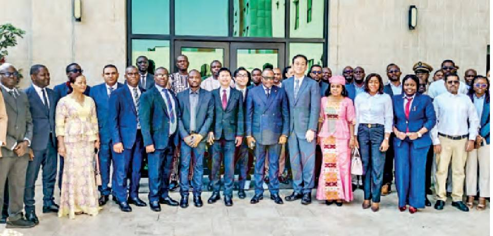
Custom Officers from across Africa and the Pacific Island are in Yaounde for their third Master Trainer Programme meant to enhance boarder safety using advanced technologies.
I n a bid to develop national ex pertise capable of training others and ensuring the sustainability of acquired knowledge that creates a genuine multiplier effect, Custom Officers from the East, West, and South African Countries as well as others from the Pacific Islands have united in Yaounde for their third Working Group activity of the Master Trainer Programme (MTP) on Geos patial Intelligence, commonly known by its acronym, GEOINT. Organized by the World Customs Organization (WCO) and the Japan International Cooperation Agency (JICA), the one- week session’s opening ceremony was chaired by the Director General of Customs Cameroon, Edwin Fongod Nuvaga on November 16, 2026. It is missioned to improve operational efficiency and geospatial intelligence of Custom Officers by empowering them with effective communication skills necessary to convey know ledge, explain technical concepts to interlocutors, and facilitate learning within and withal administrative units. Edifying the participants on the re levance of the intensive training, Edwin Fongod Nuvaga underscored that “the activity from November 16-20, 2026 takes place in a context where customs administrations are facing increasingly complex security challenges. These challenges are particularly concerning in Cameroon’s fragile border areas, where insecurity, armed conflicts, and the activities of criminal groups sometimes com promise the normal execution of customs duties.” Aware of these realities, Edwin Fon god Nuvaga explained that the WCO adopted, in June 2023, an Action Plan on Fragile Borders, which no tably encourages its members to explore innovative technologies com bining geographic data, geographic information systems, and analytical techniques, wherein GEOINT allows us to turn spatial information into actionable intelligence for operatio nal decision-making while streng thening the operational capacit...
Cet article complet est réservé aux abonnés
Déjà abonné ? Identifiez-vous >
Accédez en illimité à Cameroon Tribune Digital à partir de 26250 FCFA
Je M'abonne1 minute suffit pour vous abonner à Cameroon Tribune Digital !
- Votre numéro spécial cameroon-tribune en version numérique
- Des encarts
- Des appels d'offres exclusives
- D'avant-première (accès 24h avant la publication)
- Des éditions consultables sur tous supports (smartphone, tablettes, PC)






Commentaires